- Home
- »
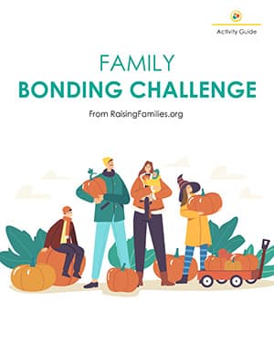
- Family Bonding Challenge
- »
- Crafts for Kids: Get...
Crafts for Kids: Get to Know Your Neighborhood with a DIY Map

Age: 3–12
Time: 10–30 minutes
Materials: pencils and paper, additional supplies as desired, such as markers, colored pencils, crayons, stickers, printed photos, compass
Focus: get to know your community
Providing lots of experiences with meaningful engagement is a major element in the recipe for a deep and lasting relationship with your kids.
This activity does not have to be complicated. Crafts for kids can often be overwhelming if you’re not already a crafty person. If this lasts 10 minutes, great! If it occupies an hour, fabulous!
Of the many crafts for kids ideas you can find online, this one is much less about the craft (the map) as it is about the conversation you have with your child while creating it.
The most important part for you as a parent is to maximize your engagement with your kids before, during, and after the actual map of your street and/or neighborhood is made.
Tips for a Great Experience Making Your Map and Learning about Your Neighborhood
- Look at maps you have at home or online for inspiration before and after your walk.
- Before you leave home, help your child draw a basic outline map of your street from memory. Include buildings, streets, and general landmarks. Identify your own home for reference.
- Think about what kind of map you’d like to make. A map of street signs? Homes with black cars? Specific trees? Yards with colorful flowers?
- Add notes and details to your map as you observe them on your walk. Take pictures for reminders if desired.
- At home, enhance your map with colored pencils, stickers, etc. Older children may want to draw a fresh map on larger paper and glue down printed photos or make a collage.
What to Talk about Once Your Map Is Completed
- Explain basic elements of reading a map, including how to find where you are to orient yourself, what a compass rose is, and how to read a legend and understand symbols used for different items.
- See if you can take turns coming up with places you might use maps (even though most of us use GPS for driving directions). For example, at shopping centers, inside office buildings, at amusement parks, public transit stations, when you’re traveling, etc.
- Share about paper maps like the Thomas Guide and generally what it was like before we had Waze, Google Maps, and GPS in our cars.
- With older kids, explore Google Earth online and discuss what GPS is and how satellites take pictures of our earth and can make incredibly detailed maps.
- Read a pirate adventure story, and explain the phrase “X marks the spot!”
- Who did you meet on your walk around the neighborhood?
- Did you notice anything different than when you’re driving in the car?
- What is a topographer? How is it different than a cartographer?
Join the Community!

Get Excited About Your Future
Delight your inbox with monthly lessons carefully chosen to help you grow as a proactive parent who's always looking to learn more about raising a strong family team.

Monthly Live Engagement
Join our monthly live chats to discuss each month's topic in-depth and get all your questions answered.

Worksheets and Guidebooks to Grow Better Together
Members receive many of our guides for free and access to deep discounts to the entire collection to continue growth and development together.
Somer Loomis
Somer is the Chief Content Officer at Raising Families living in Southern California with her seven-year-old son and two-year-old daughter. She spent 10 years in the architecture field as a designer and medical planner and now applies her love of integrative thinking and big-picture planning to her family and career.
In her free time she loves to try new recipes she knows her children will never eat and do art projects she saved on Pinterest at least five years ago. Read full bio >>


